The Gough Map is the oldest known representation of the British Isles in a recognisable geographic form, yet questions remain regarding how the map was made, who made it, when and why.
Background
The Gough Map website presents an interactive, searchable edition of the Gough Map, together with contextual material. Last year the project website was succesfully migrated to the Bodleian Library for hosting. We're pleased that this unique resource will be preserved for many years to come at its spiritual home.
In early 2010, the Bodleian Library undertook a new scan of the manuscript as part of a conservation exercise, giving the project a better scan with improved resolution. It made sense therefore for ‘Linguistic Geographies’ to use this new map-scan, rather than the first, so the online map-resource makes use of this.
Queen's University Belfast used ArcGIS to digitise the features on the map as vector data, and it is this information that helps to make the online resource searchable and draw the user to important details.
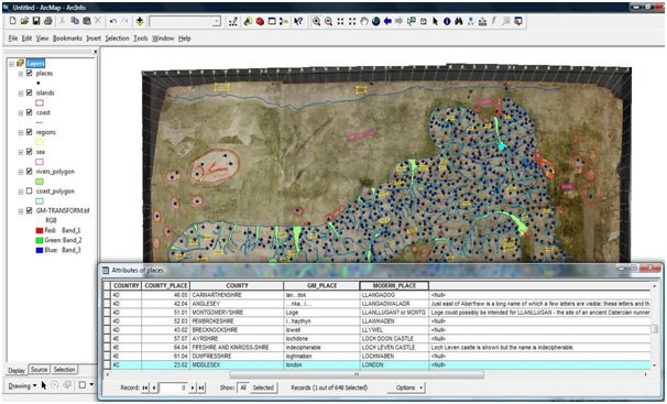
QUB's digitisation process, working with ESRI ArcGIS
Gough Map was also developed as one of the first King's DH projects to make full use of the Django web application framework. As well as providing a powerful development platform and data modelling opportunities, it gave the investigating project team increased control over the content of their site, regular blog updates and integration of their research data.
KDL have continued to refine an effective workflow for projects based in Django implementations and it is now our standard approach for client controlled content management.
The digital presentation of the online map uses a combination of technologies to ensure a slick and fast map response that the general user has become accustomed to.
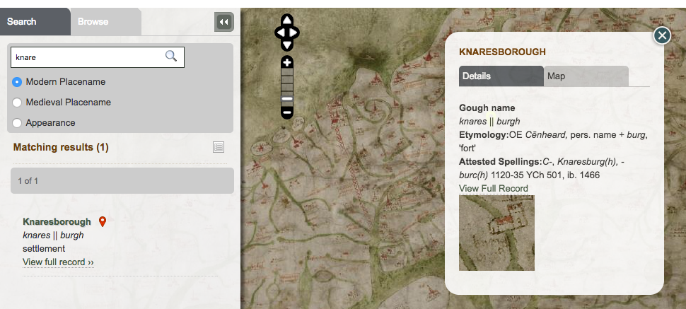
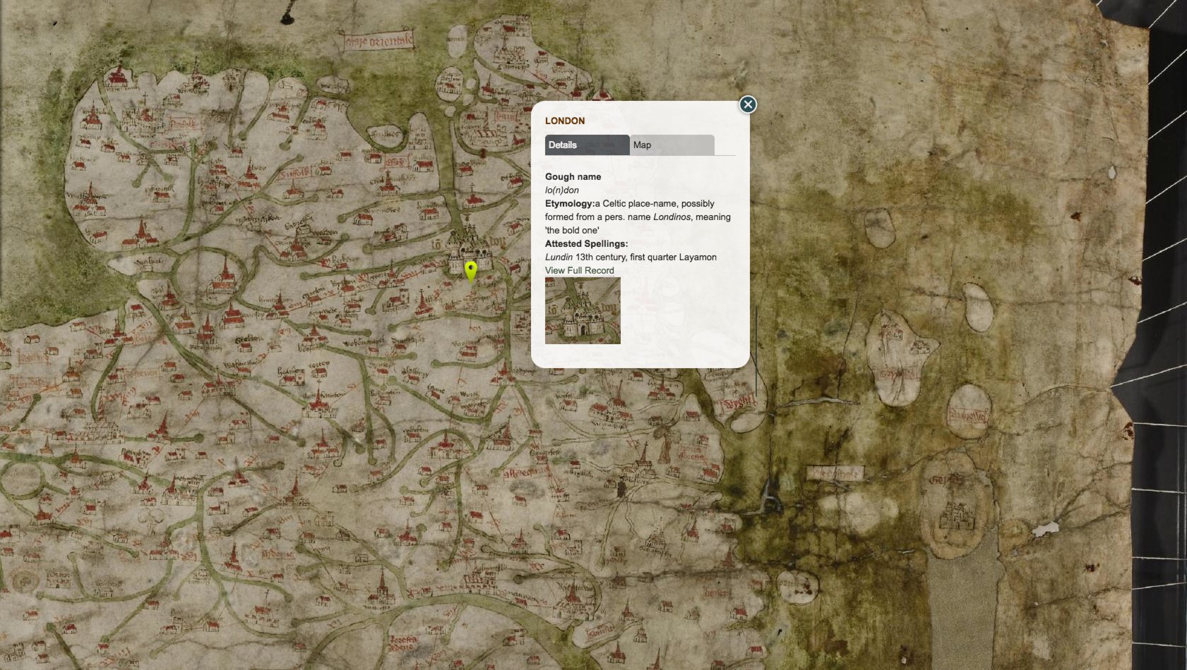
The Gough Map interface allows interaction with the map and offers an interpretive journey
How we worked
-
Collaboration
King's worked with QUB to to integrate their digital map capture into a format that enabled structured data search
-
Investigation
We identified and evaluated several competing web map technologies for the best project fit, compatibility and ease of use, settling on a resilient stack of software
-
Design
In order to recreate the experience of viewing this large and distinctive document, the design and layout paid great attention to maximising the visible area of the map and reducing clutter on the interface
-
Impact and sustainability
The final website is an important national resource which makes public, a key document from Britain's history
Who we worked with