

Adding a spatial component to existing data or making use of the spatial data that is already implicit in your content, is becoming a standard approach for presenting and exploring academic topics. KDL can advise you on how to capture the information you will need to enhance your work with maps, and explore the potential of rigorous spatial research methods.
For the technically minded, most KDL project databases reside on PostgreSQL servers with PostGIS extensions enabled, so the options for exploiting spatial relationships in data are maximised. We use ArcGIS and QGIS desktop applications to perform close analysis, geo-processing and data editing. Data will often be displayed on a web-based map and our GeoServer and Mapserver can be used to supply bespoke styled maps for web display, in combination with community mapping resources, such as LeafletJS or OpenLayers.
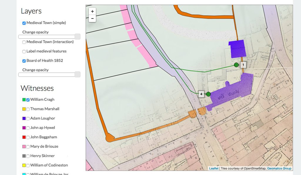
CityWitness brought together modern maps and historic maps and combined the narrative of William Cragh's execution to create an interface for exploring medieval Swansea
Having a spatially enabled dataset isn't simply about displaying maps, though. Perhaps more importantly, it can create new dimensions for analysis: spatial co-dependency, correlation, heat-maps, kriging, clustering and so forth. KDL can advise on using these methods to bring out the story in the data whilst making sure the techniques are applied correctly and the results stand up to scrutiny.
Spatial information needs to be considered at an early stage of data collection, to ensure that the structure of the data is sufficient for intended outputs. Processes such as automatic geocoding of addresses or place names often rely on strict and consistent conventions being adhered to, to avoid complications and delays further down the line.
KDL projects such as AEMA, have made complex geographical data available to the wider research community and helped to refine standards for dissemination of spatial information and geographical searches.
Please get in touch if you have questions about how to go about realising the potential of mapping in your research.